
The Gently Mad Book Shop
Great Britain's Coasting Pilot : Captain Greenville Collins : Sailing 1753
Great Britain's Coasting Pilot : Captain Greenville Collins : Sailing 1753
Regular price
£225.00 GBP
Regular price
Sale price
£225.00 GBP
Unit price
per
Tax included.
Couldn't load pickup availability
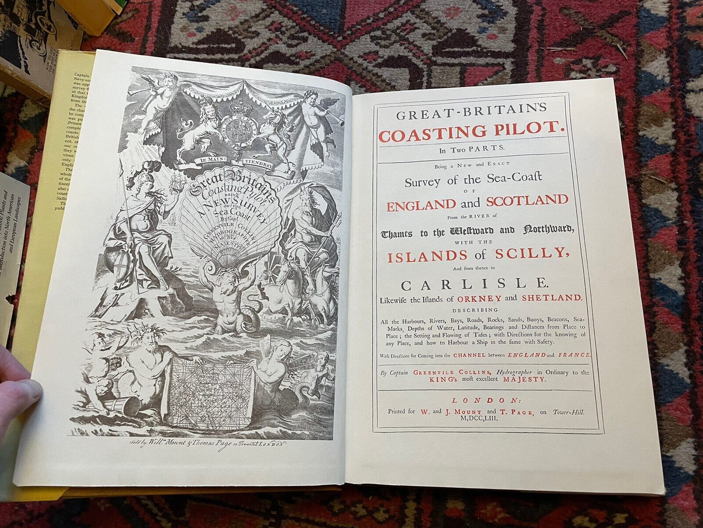
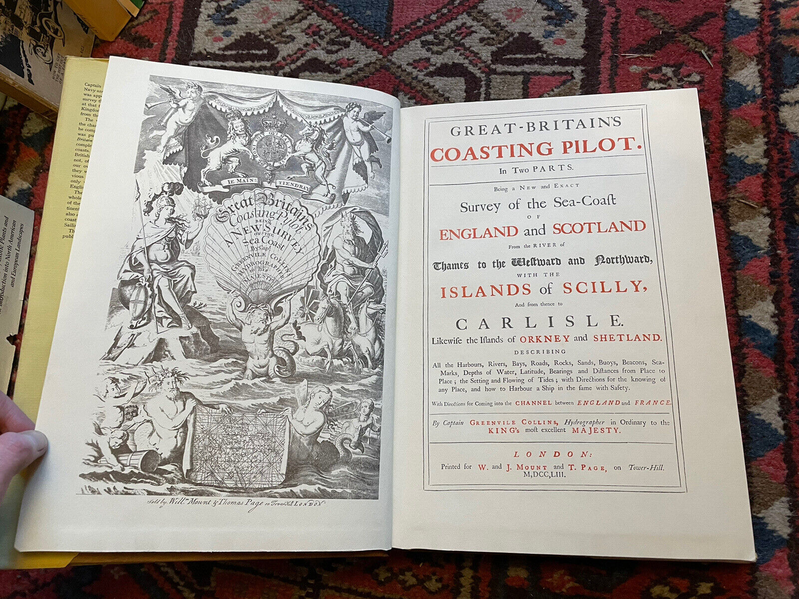
GREAT-BRITAIN'S COASTING PILOT
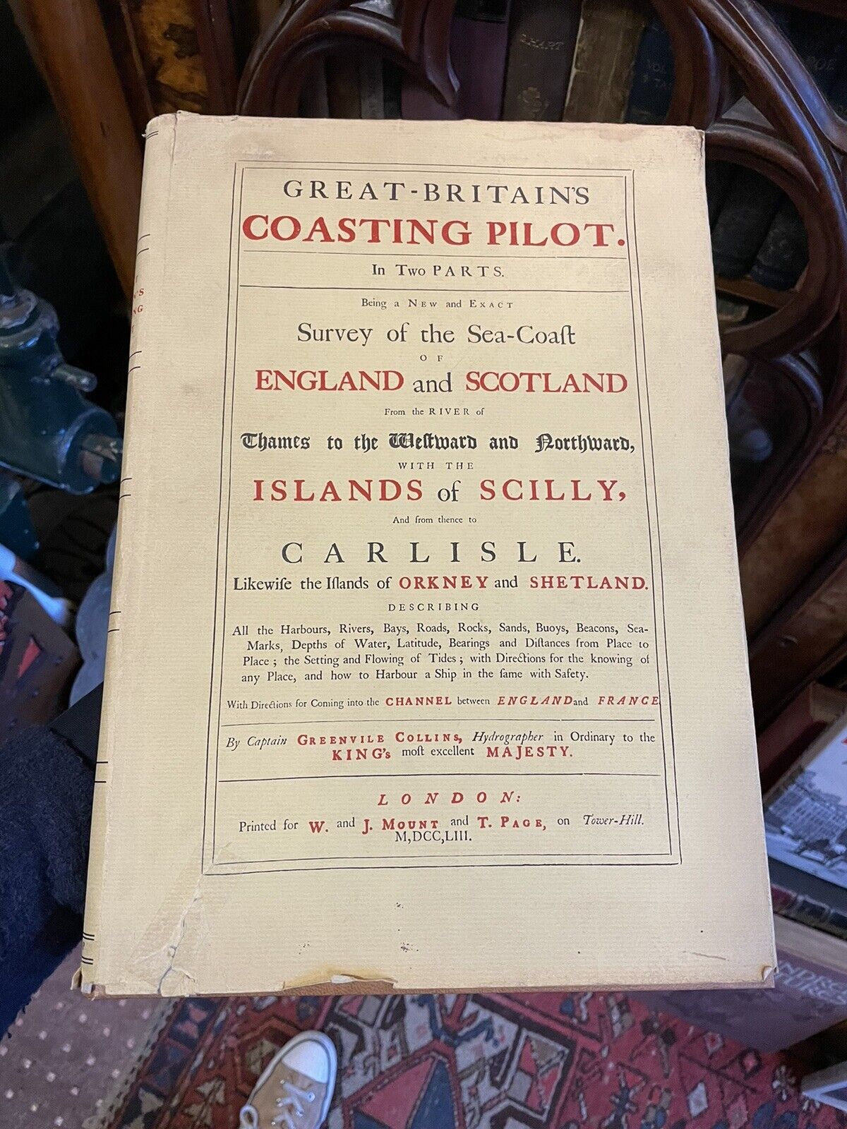
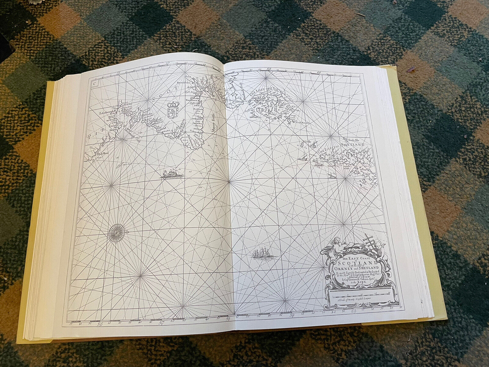
In Two Parts. Being a New and Exact Survey of the Sea-Coast of England and Scotland From the River of Thames to the Westward and Northward, With the Islands of Scilly, And from thence to Carlisle. Likewise the Islands of Orkney and Shetland. Describing All the Harbours, Rivers, Bays, Roads, Rocks, Sands, Buoys, Beacons, SeaMarks.With Directions for Coming into the Channel between England and France
By Captain Greenville Collins
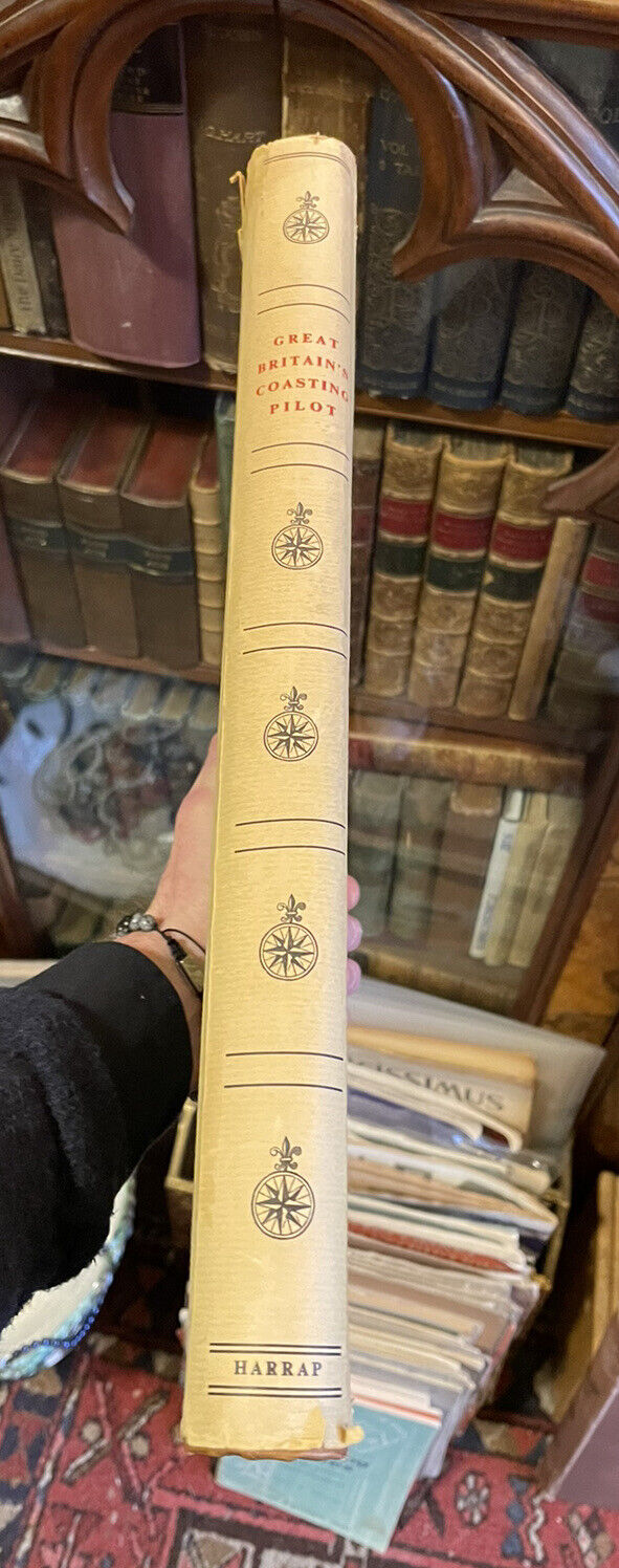
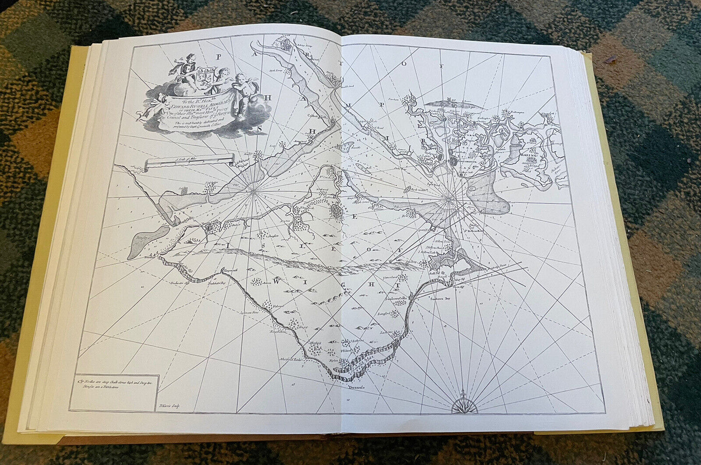
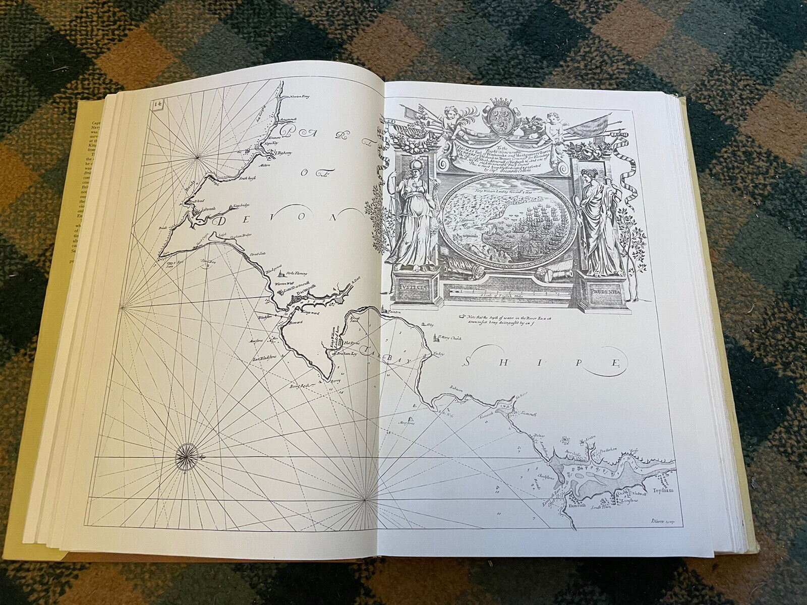
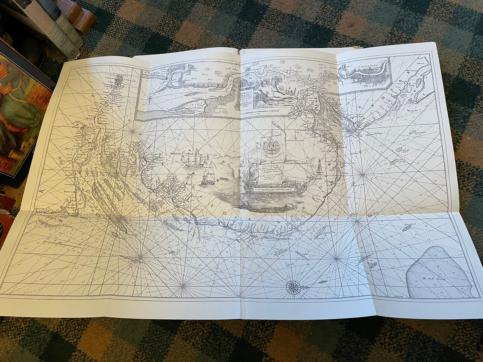
Published by The Sudbrook Press Prestwood Buckinghamshire, undated. Facsimile Reprint of the Mount and Page 1753 first edition. Folio. [vi] + 26pp. 47 charts including many double page and several folding.
CONDITION
A good copy. The dust jacket is generally good with a couple of repairs. Boards and spine are good. All contents present including all charts. Pages clean throughout. Overall a good copy.
Greenville Collins (1669-1693) was an officer in the Royal Navy, who saw active service in operations against Algerian pirates, and served with Sir John Narborough in his expedition to southern South America and the Straits of Magellan (1669-1671) where he first practiced his chart-making skills).
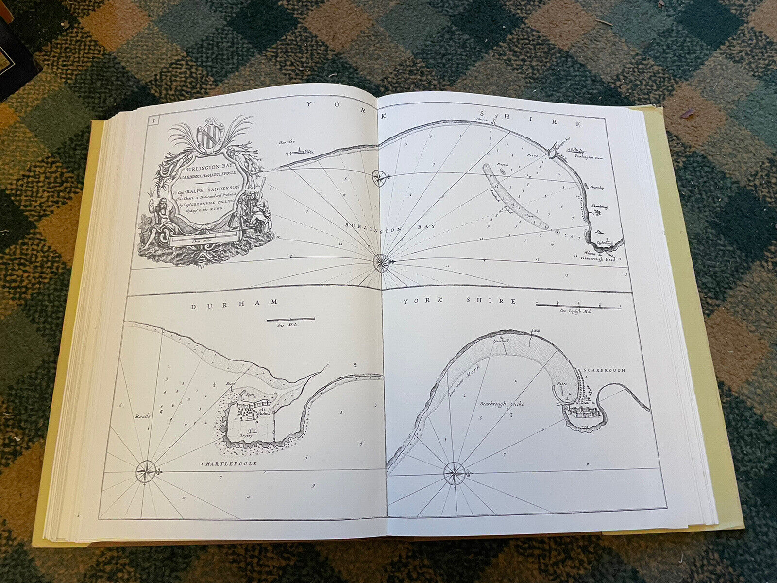
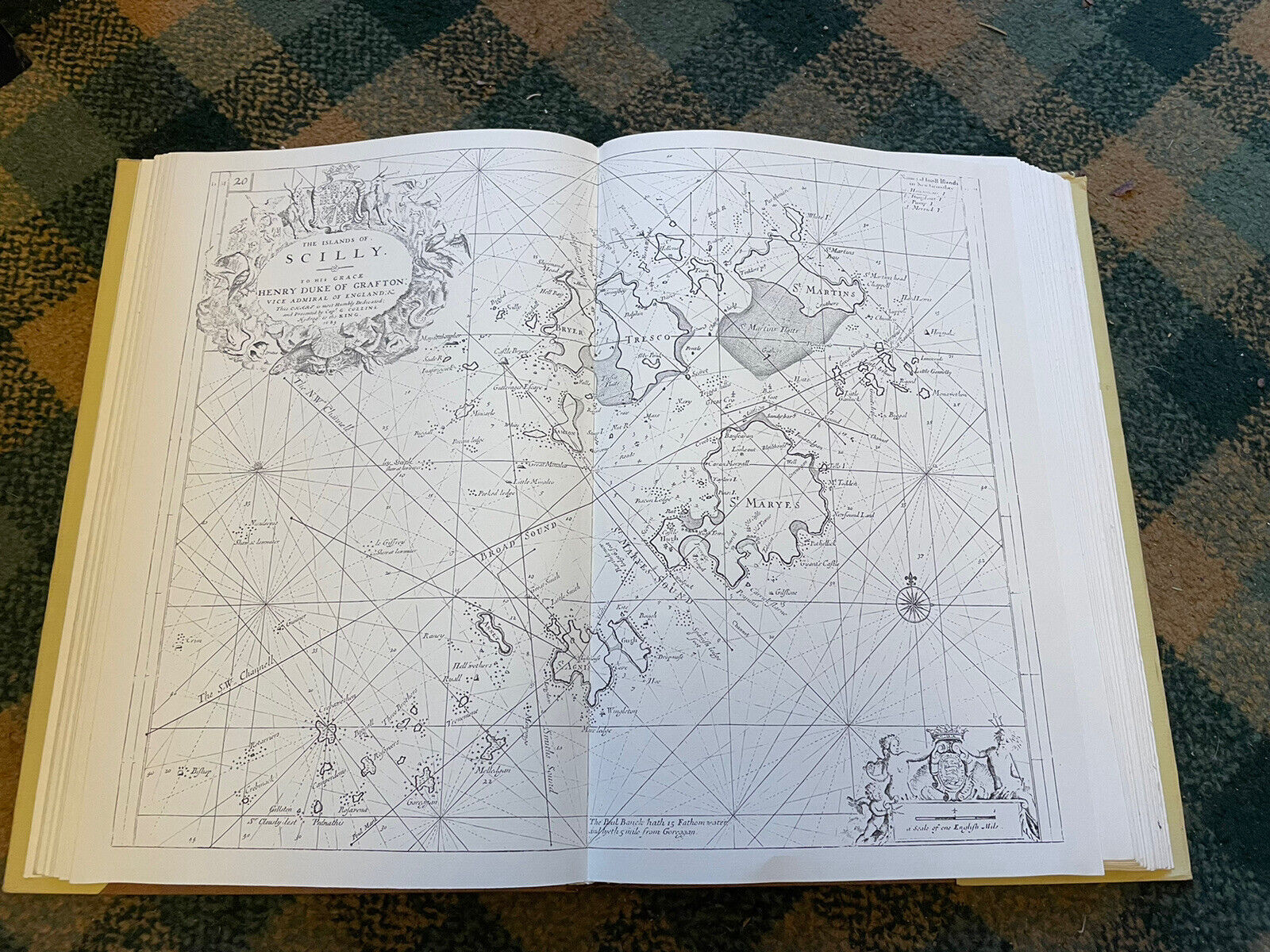
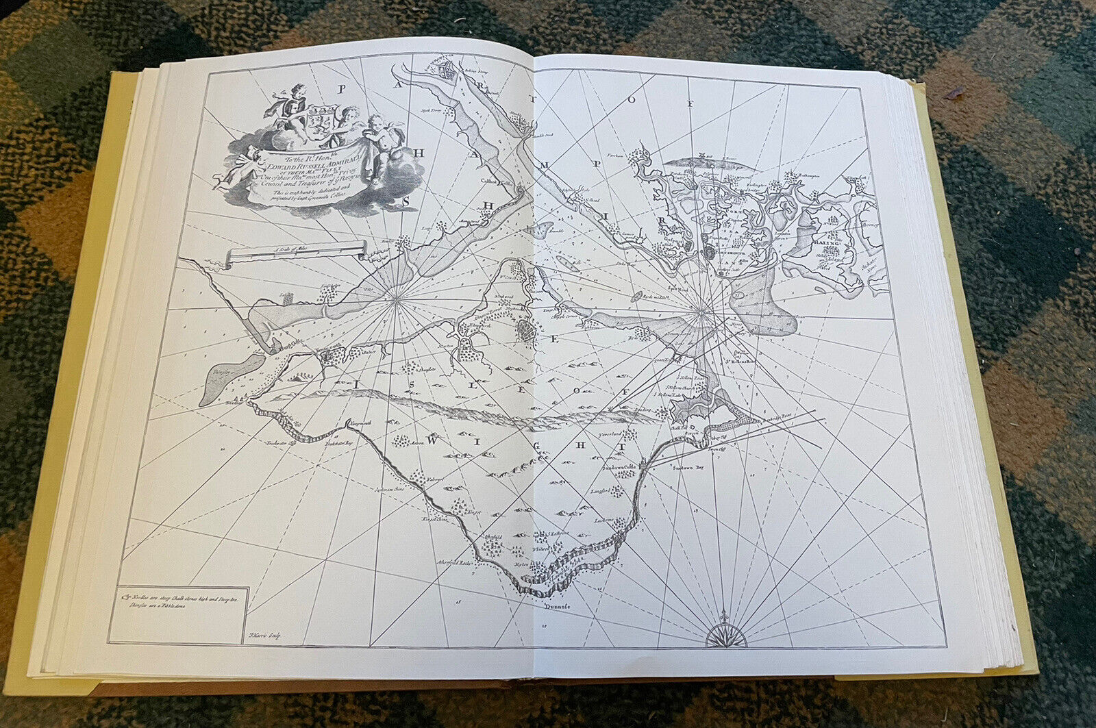
In the early 1680s, Collins proposed that he undertake a full-scale survey of the British coastal waters, a project long overdue. The vast majority of existing charts were of Dutch origin, and often much out-dated. King Charles II was persuaded and funding promised, and in 1681 Collins was given command of the yacht 'Merlin', and sent to survey the British coasts. In the course of the survey, between 1681 and 1688, Collins produced about 120 manuscript charts, from which were produced forty-seven engraved charts, covering most of the British Isles: the western coast of Scotland and western coast of Ireland were omitted, perhaps because of the difficulties Collins experienced in getting paid; he was compelled to use his own money, and extended credit, in order to complete the work. Collins' 'Great Britain's Coasting Pilot', as it was termed, was first published in 1693, advertised in the 'London Gazette' for 20th - 23rd February 1693; it seems likely that the cost of publishing was born by Richard Mount, who appears on the title-page as selling the book. Certainly the plates passed into the ownership of Mount's heirs and successors, who published subsequent editions.
Collins' pilot represents the first systematic survey of the waters it covers, the first series of charts of British waters drawn by an Englishman, as well as being the first marine atlas engraved and printed in London from original surveys, so a landmark in British chart-making and publishing. It can also be credited as one of a group of publications that helped break British dependence on Dutch chart-publishers for maritime materials. The 'Great Britain's Coasting Pilot' proved enduringly popular; it remained in print for one hundred years and for most of that time was the best chart book of British coastal waters; it was only in the 1770s that rival publishers began to produce a superior chart book. This printing appeared during the Seven Years' War when Britain was under threat of invasion from France.
In Two Parts. Being a New and Exact Survey of the Sea-Coast of England and Scotland From the River of Thames to the Westward and Northward, With the Islands of Scilly, And from thence to Carlisle. Likewise the Islands of Orkney and Shetland. Describing All the Harbours, Rivers, Bays, Roads, Rocks, Sands, Buoys, Beacons, SeaMarks.With Directions for Coming into the Channel between England and France
By Captain Greenville Collins
Published by The Sudbrook Press Prestwood Buckinghamshire, undated. Facsimile Reprint of the Mount and Page 1753 first edition. Folio. [vi] + 26pp. 47 charts including many double page and several folding.
CONDITION
A good copy. The dust jacket is generally good with a couple of repairs. Boards and spine are good. All contents present including all charts. Pages clean throughout. Overall a good copy.
Greenville Collins (1669-1693) was an officer in the Royal Navy, who saw active service in operations against Algerian pirates, and served with Sir John Narborough in his expedition to southern South America and the Straits of Magellan (1669-1671) where he first practiced his chart-making skills).
In the early 1680s, Collins proposed that he undertake a full-scale survey of the British coastal waters, a project long overdue. The vast majority of existing charts were of Dutch origin, and often much out-dated. King Charles II was persuaded and funding promised, and in 1681 Collins was given command of the yacht 'Merlin', and sent to survey the British coasts. In the course of the survey, between 1681 and 1688, Collins produced about 120 manuscript charts, from which were produced forty-seven engraved charts, covering most of the British Isles: the western coast of Scotland and western coast of Ireland were omitted, perhaps because of the difficulties Collins experienced in getting paid; he was compelled to use his own money, and extended credit, in order to complete the work. Collins' 'Great Britain's Coasting Pilot', as it was termed, was first published in 1693, advertised in the 'London Gazette' for 20th - 23rd February 1693; it seems likely that the cost of publishing was born by Richard Mount, who appears on the title-page as selling the book. Certainly the plates passed into the ownership of Mount's heirs and successors, who published subsequent editions.
Collins' pilot represents the first systematic survey of the waters it covers, the first series of charts of British waters drawn by an Englishman, as well as being the first marine atlas engraved and printed in London from original surveys, so a landmark in British chart-making and publishing. It can also be credited as one of a group of publications that helped break British dependence on Dutch chart-publishers for maritime materials. The 'Great Britain's Coasting Pilot' proved enduringly popular; it remained in print for one hundred years and for most of that time was the best chart book of British coastal waters; it was only in the 1770s that rival publishers began to produce a superior chart book. This printing appeared during the Seven Years' War when Britain was under threat of invasion from France.
(Loc: Shop; Platform; Top of History box shelf)