The Gently Mad Book Shop
1792 Taylor & Skinner's Survey of the Roads of Scotland : Scarce Pocket Edition
1792 Taylor & Skinner's Survey of the Roads of Scotland : Scarce Pocket Edition
Couldn't load pickup availability
Taylor & Skinner's Survey of the Roads of Scotland on an Improved Plan:
To which is Prefixed an Accurate Map of Scotland and the New Roads since the Survey was taken.
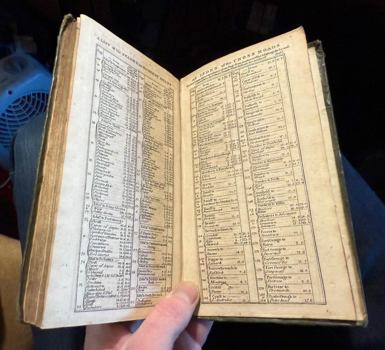
Edinburgh: Thos. Brown, no date [c.1792]. Full leather binding with red titlepiece, small 8vo, engraved title, 178 road maps printed double sided including two on fold-out plate, 8 page index. As with the copies that have previous come up for sale at auction it is lacking its general map (believed to have been originally sold seperately),
CONDITION
A good complete copy (except for the folding general map). The leather binding has some loss at the foot of the spine and some wear down the shoulders but both boards securely attached. Two bookplates at the front of the book Sir Alexander Gibb + Jocelyn & Elizabeth Gibb). Title page good with some light grubbiness. All 178 road maps present and in good condition. Overall a good copy.
THE FIRST ROAD BOOK OF SCOTLAND
The first road strip maps of England and Wales were published by John Ogilby in his landmark ‘Britannia’ in 1675. A similar work on Scotland did not appear until this one by George Taylor (fl. 1772-1807) and Andrew Skinner in 1776. Following unification, the eighteenth century saw a large expansion in the road network of Scotland. With military oversight about 1000 miles of roads were built between 1725 and 1767, most being constructed following the Rebellion of 1745.
George Taylor was one of three brother who all worked in cartography. George was a land surveyor in Aberdeen and by the mid-1770s was working in partnership with Andrew Skinner (fl. 1776-81) in Edinburgh. Taylor & Skinner’s ‘Survey and maps of the Roads of North Britain or Scotland’ was dedicated to the Duke of Argyll, the Commander in Chief of the Armed Forces in Scotland. Several engravers were employed including John Barber, Thomas Bowen, John Luffman, Stephen Pyle, John Roberts, Isaac Taylor and Garnet Terry. Its format was unusual being very tall plates about 47 by 19 cms. each. The 61 maps each contain three road strips. The work enables over 3000 miles of roads to be covered to a scale of 1 inch to the mile.
The project began most likely in 1775 as each plate is dated between June 1775 and February 1776. It was not however a financial success and in July 1775 and 1776 they applied for financial support from the Commissioners for the Forfeited Estates. A manuscript road book by George Taylor survives in Cambridge University Library entitled ‘Sketches of the Roads in Scotland’ dated 1785. It contains 103 detailed coloured maps complete with written notes.
(Desk/Lower Shelf)